 Welcome to the First Month of our
Geography Terms Tour!

September’s Term is – Cliffs
During the month of September we will be traveling to Asia
to visit the
Great Trango Tower in Pakistan’s Baltoro Glacier Region .
(If you are already on a Geography Journey of your own,
with a different tour director, see if they could show you
where the highest cliff is located in your September Journey!)
Things you may need for your journey –
PASSPORTS
Your kiddos might enjoy a family passport for the year. We have used stickers or rubber stamps to mark our journey in a passport for two years. The boys have really enjoyed it!
- Enchanted Learning Simple Black and White Passport
- Very Nice Full Color Free Downloadable Printable Passports
LAPBOOK/NOTEBOOK
We have had the most fun with lapbooks. The boys fill an 8 x 11 piece of construction paper with items from their travels. We have played with Notebooking Pages as well, but my boys I like crafts a bit better.
Flags – Create a flag out of construction paper – print a flag to color from Enchanted Learning – or free hand a map with colored markers. <<Enchanted Learning Link to Pakistan’s Flag>>
Maps – We like to create topography maps, bird migration maps, or just major landmark maps. Blank Map of Asia Asian Geographic Regions World Atlas Map of Asia
You Tube Videos can help a child see where you are going – there is a very graphic base jumping video for the Trango Towers – <<ABC posted a free fall YouTube Video Here>>.
Wall Paper – You may want to find a great graphic and set it as a wallpaper on your computer for a time this month. I selected <<this Trango Tower Photo>> for our computer wallpaper.
Find Geography Notebooking Ideas!
We are working on goals given to us in the Ultimate Geography and Timeline Guide by Maggie Hogan a Cindy Wiggers. We will be working out of the Middle School section. This book has the Terms, ways to mark a map, notebooking ideas, full Unit Study History lessons, Maps, Activities, Reproducibles and Timeline Figures. You can get yours today from Timberdoodle . com <<Click here >>
In Elementary School we used Galloping the Globe for our ideas. <<Click here to pick one up at Timberdoodle.com>>
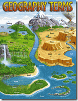
I have a poster that we are using or our Terms Guide – <<You may order one Here>>
I can’t wait to see what you come up with! We started out with coloring flags and pointing to a continent on a globe – now we are moving up to detailing rivers and mountain regions, labeling cities and geographical areas on he map – to performing traditional dances – to following the GPS of migratory birds – to cooking a meal a month from the country – to finding one animal in the country – to making a 3D image of a significant structure – to writing essays about their history. How little or much is up to you – your time – and never forgetting – the interest of your child.
 Post your Blog Link or
summary of your Geography Journey
in the comments!
or
Join us in the Blog Carnival – geography terms tour – Oct 1, 2010 edition.
(Look at the upper right hand side of the Carnival Page for the ORANGE box that says Submit your Blog Article To this Carnival.)


 +Angie Wright